Mapping
Mapping can be used to navigate and support the completion of inspections in TabletGAD, an example of the mapping is shown below:
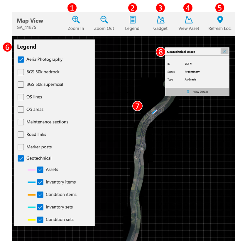
The following components are available in TabletGAD:
-
Zoom in and out buttons
-
Toggle legend (6) button
-
Go to GADGET
-
Go to Asset Details
-
Refresh GPS location
-
Legend - Allows you to select which layers are visible
-
Mapping window - shows all mapping layers
-
Pop up box - shows key information of what is selected in the map and button to navigation to object information.
Selecting objects on the map
Objects can be selected on the map. When selected, they will show as highlighted on the map. If a GAD object is selected, you will be able to press View Details to see the object information.
The map can be navigated using touch or with a stylus. Standard interactions such as pinch to zoom are enabled. Buttons on the top bar (1) allow zoom using a stylus.
GPS Location
A marker shows your current GPS position on the map, press refresh location (5) to update the position.